


引言:应急救援无人机技术的战略价值与发展态势/Introduction: The Strategic Value and Development Trend of Emergency Rescue UAV Technology
随着全球气候变化加剧和城市化进程加速,自然灾害和突发事件频发,传统应急救援方式在复杂环境下面临响应速度慢、作业效率低、人员安全风险高等挑战。无人机技术凭借其快速部署、灵活机动、实时传输及高精度定位等优势,正在重塑应急救援体系的技术架构和作业模式。
With the intensification of global climate change and the acceleration of urbanization, natural disasters and emergencies occur frequently. Traditional emergency rescue methods are confronted with challenges such as slow response, low operational efficiency and high personnel safety risks in complex environments. With its advantages of rapid deployment, flexibility, real-time data transmission and high-precision positioning, UAV technology is reshaping the technical framework and operational mode of the emergency rescue system.
当前,应急救援无人机已从早期的辅助角色发展为核心救援力量,应用场景涵盖自然灾害救援、城市消防、海上搜救、危化品事故处置等多个领域。特别是在"三断"(断路、断电、断通信)极端环境下,无人机展现出"空中生命线"的独特价值,单次救援响应时间可缩短至5分钟,显著提升了救援效率。
At present, emergency rescue UAVs have evolved from an auxiliary role in the early stage to a core rescue force, with application scenarios covering natural disaster relief, urban fire fighting, maritime search and rescue, hazardous chemical accident disposal and other fields. Especially in the extreme environment of "three disruptions" (road disruption, power disruption and communication disruption), UAVs demonstrate the unique value of an "aerial lifeline". The single rescue response time can be shortened to 5 minutes, which significantly improves rescue efficiency.
2025年以来,随着人工智能、5G通信、氢燃料电池等前沿技术的深度融合,应急救援无人机在智能化、集群化、重载化方面取得重大突破。中国已构建起全球规模最大的无人机应急响应体系,单次任务可调度多达500架无人机协同作业。工信部于2025年7月启动"大荷载无人机救援装备"项目,标志着我国应急救援无人机技术进入新的发展阶段。
Since 2025, with the in-depth integration of cutting-edge technologies such as artificial intelligence, 5G communication and hydrogen fuel cells, emergency rescue UAVs have achieved major breakthroughs in intelligence, clustering and heavy-lift capability.
China has established the world's largest UAV emergency response system, which can deploy up to 500 UAVs for collaborative operations in a single mission.
The Ministry of Industry and Information Technology launched the "Heavy-Load UAV Rescue Equipment" project in July 2025, marking that China's emergency rescue UAV technology has entered a new stage of development.
本研究旨在全面梳理应急救援无人机的技术类型、应用场景和性能特点,从技术研发、采购决策、应急响应规划等多角度进行深入分析,为相关部门和企业的装备配置、技术选型和应急体系建设提供科学依据。
This study aims to comprehensively sort out the technical types, application scenarios and performance characteristics of emergency rescue UAVs, conduct in-depth analyses from the perspectives of technical research and development, procurement decision-making and emergency response planning, so as to provide a scientific basis for equipment allocation, technical selection and the construction of emergency systems by relevant departments and enterprises.
一、应急救援无人机分类体系与技术特征
1. Classification System and Technical Characteristics of Emergency Rescue UAVs
1.1 按气动布局分类的技术谱系
应急救援无人机按气动布局可分为四大技术类型,每种类型都有其独特的技术特征和应用优势 :
1.1 Technical Spectrum Classified by Aerodynamic Layout
Emergency rescue UAVs can be divided into four major technical types according to their aerodynamic layout, each with unique technical characteristics and application advantages:
固定翼无人机具有长航时、大航程的特点,巡航速度通常在80-150km/h,续航时间可达1-6小时,适用于大范围灾区测绘、快速灾情巡查、长距离物资投送和通信中继平台等任务。这类无人机在森林火灾监测、洪水灾情评估等需要长时间持续作业的场景中发挥重要作用。
Fixed-wing UAVs are characterized by long endurance and long range. Their cruising speed is usually 80–150 km/h, with endurance ranging from 1 to 6 hours. They are suitable for tasks such as large-scale disaster area mapping, rapid disaster inspection, long-distance material delivery, and communication relay. Such UAVs play an important role in scenarios requiring long-duration operations, including forest fire monitoring and flood disaster assessment.
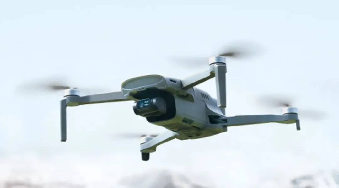
多旋翼无人机以其垂直起降和精准悬停能力著称,飞行速度为15-60km/h,续航时间15-40分钟(电动版),载荷能力0.1-20kg。多旋翼无人机特别适合局部精细化侦察、人员搜救、小批量精准物资投送、现场照明和空中喊话等任务。在城市消防救援中,多旋翼无人机能够在复杂建筑环境中灵活穿行,执行精准救援任务。
They are particularly suitable for tasks such as local refined reconnaissance, personnel search and rescue, small-batch precise material delivery, on-site lighting, and aerial broadcasting. In urban fire and rescue operations, multi-rotor UAVs can maneuver flexibly in complex built environments to carry out precise rescue missions.
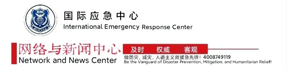
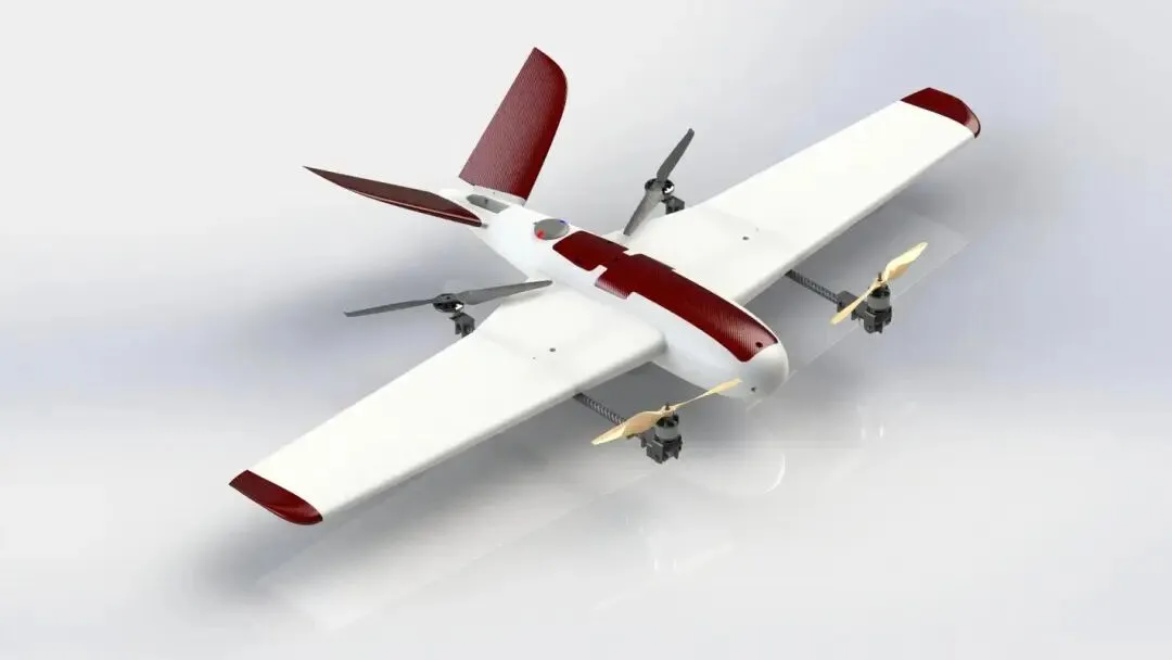
垂直起降固定翼无人机融合了固定翼和旋翼的技术优势兼具长航时、大载荷与垂直起降的灵活性 。这类无人机可同时搭载光电吊舱、PDT集群基站、宽带自组网、三维建模等多种任务载荷,单次飞行即可完成灾情侦查、应急测绘、应急通信保障等综合任务 。
Vertical take-off and landing fixed-wing UAVs integrate the technical advantages of fixed-wing and rotorcraft, combining long endurance, heavy payload and the flexibility of vertical take-off and landing.
Such UAVs can carry multiple mission payloads simultaneously, including electro-optical pods, PDT trunking base stations, broadband ad hoc networks, and 3D modeling equipment. They can complete comprehensive tasks such as disaster reconnaissance, emergency mapping, and emergency communication support in a single flight.
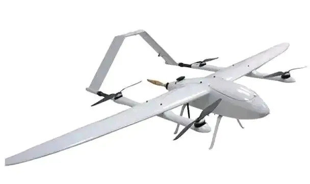
无人直升机在重型载荷投送方面具有独特优势,有效载荷可达200kg以上,能够执行重型物资投送、大型救援设备吊运、搭载大型专用任务设备等任务。联合飞机的TD550无人直升机载重达200kg,首创"三断"环境通信中继技术,在极端环境下展现出卓越性能。
Unmanned helicopters have unique advantages in heavy-lift delivery, with an effective payload of more than 200 kg. They can perform tasks such as heavy material delivery, lifting large rescue equipment, and carrying large‑scale special mission equipment.
The TD550 unmanned helicopter developed by Joint Aircraft has a payload capacity of 200 kg and pioneered the communication relay technology for "three disruptions" environments, demonstrating outstanding performance in extreme conditions.
1.2 按应用场景分类的任务体系
应急救援无人机的应用场景已扩展至9大类58个具体任务,形成了覆盖灾害全生命周期的完整应用体系:
1.2 Task System Classified by Application Scenarios
The application scenarios of emergency rescue UAVs have expanded to 9 major categories and 58 specific tasks, forming a complete application system covering the entire disaster life cycle:
通信保障类包括应急指挥专网覆盖、信号中继、指挥调度等3个场景,在"三断"环境下构建空中通信生命线。湖北为11个市州配发的中型复合翼无人机可在"三断"情况下1小时快速组网,推动构建全省"1小时无人机服务圈"应急救援指挥通信体系 。
Communication support covers three scenarios: emergency command private network coverage, signal relay, and command dispatch. It establishes an aerial communication lifeline under "three disruptions" conditions. The medium-sized hybrid-wing UAVs distributed by Hubei to 11 prefecture-level cities can rapidly set up a network within one hour in such conditions, helping to build a provincial "1-hour UAV service circle" emergency rescue command and communication system.
侦察测绘类涵盖灾情侦察、全景图拍摄、三维建模、正射测图等12个场景,为救援决策提供精准的空间信息支撑。在四川宜宾山体滑坡灾害中,救援人员利用无人机搭载倾斜摄影载荷,快速制作灾区三维实景图,为灾情评估提供了关键数据。巡查监测类包括火场态势监测、灾场气象监测、有害气体监测等16个场景,实现对灾害现场的全方位实时监控。在宁夏固原汽油槽罐车侧翻事故中,无人机搭载气体检测传感器,实时回传浓度、分布及扩散趋势数据,为救援决策提供了重要支持。
Reconnaissance and mapping cover 12 scenarios, including disaster reconnaissance, panoramic image capture, 3D modeling, and orthophoto mapping, providing accurate spatial information support for rescue decision-making.
During the landslide disaster in Yibin, Sichuan, rescue personnel used UAVs equipped with oblique photography payloads to quickly produce 3D real-scene maps of the disaster area, offering critical data for disaster assessment.
Patrol and monitoring cover 16 scenarios, including fire scene situation monitoring, disaster area meteorological monitoring, and hazardous gas monitoring, realizing all-round real-time monitoring of disaster sites.
In the gasoline tanker rollover accident in Guyuan, Ningxia, UAVs equipped with gas detection sensors transmitted real-time data on concentration, distribution and diffusion trends, providing important support for rescue decision-making.
消防灭火类涵盖吊桶灭火、投弹灭火、提拉水带灭火、空中破窗等11个场景,形成了立体化的空中灭火体系。在2025年岳阳楼区森林防火演练中,天眸航空K-50灭火无人机携带两枚25公斤灭火弹,在火源上方1-3米精准引爆,压制400平米左右的火势 。
投送运输类包括装备投送运输、物资投送运输、人员投送运输等3个场景,解决了灾害环境下的物资运输难题。在2024年西藏林芝雪瓦卡村桥梁被冲毁的救援中,高原型直升机飞行5架次,运送物资600余公斤,有力支援了灾害救援现场。
救援处置类涵盖红外及可见光搜救、手机信号搜索定位、救援引导、应急照明等10个场景,为被困人员提供全方位救援支持。在2024年广东江门恩平河排森林公园人员迷路救援中,无人机通过激光和探照灯引导行进路线,帮助3名被困人员成功获救。
1.2 Task System Classified by Application Scenarios
The application scenarios of emergency rescue UAVs have expanded to 9 major categories and 58 specific tasks, forming a complete application system covering the entire disaster life cycle:
Communication Support includes 3 scenarios: emergency command private network coverage, signal relay, and command scheduling, which build an aerial communication lifeline in "three disruptions" environments. The medium‑scale composite‑wing UAVs allocated by Hubei to 11 prefecture‑level cities can rapidly establish a network within one hour under "three disruptions" conditions, promoting the construction of a provincial emergency rescue command and communication system featuring a "one‑hour UAV service circle".
Reconnaissance and Mapping covers 12 scenarios, such as disaster reconnaissance, panoramic image acquisition, 3D modeling, and orthophoto mapping, providing accurate spatial information support for rescue decision‑making. In the landslide disaster in Yibin, Sichuan, rescuers used UAVs equipped with oblique photography payloads to quickly generate 3D real‑scene maps of the disaster area, supplying critical data for disaster assessment.
Patrol and Monitoring includes 16 scenarios, including fire situation monitoring, disaster site meteorological monitoring, and hazardous gas monitoring, realizing all‑round real‑time monitoring of disaster sites. In a gasoline tanker rollover accident in Guyuan, Ningxia, UAVs equipped with gas detection sensors transmitted real‑time data on concentration, distribution, and diffusion trends, providing important support for rescue decisions.
Fire Fighting covers 11 scenarios, such as bucket fire extinguishing, fire extinguishing bomb delivery, hose lifting, and aerial window breaking, forming a three‑dimensional aerial fire suppression system. In the 2025 forest fire prevention drill in Yueyanglou District, Tianmu Aviation’s K‑50 fire‑fighting UAV carried two 25‑kg fire extinguishing bombs and detonated them precisely 1–3 meters above the fire source, suppressing an area of about 400 square meters.
Delivery and Transportation includes 3 scenarios: equipment delivery, material delivery, and personnel delivery, solving the problem of material transportation in disaster environments. In the 2024 rescue operation in Xuewaka Village, Linzhi, Xizang, where bridges were destroyed, plateau‑type helicopters completed 5 sorties and delivered more than 600 kg of supplies, strongly supporting the disaster relief effort.
Rescue and Disposal covers 10 scenarios, including infrared and visible light search and rescue, mobile phone signal search and positioning, rescue guidance, and emergency lighting, providing all‑round support for trapped people. In the 2024 rescue of lost personnel in Hepai Forest Park, Enping, Jiangmen, Guangdong, UAVs guided the travel route via lasers and searchlights, helping three trapped people escape successfully.
1.3 按载荷能力分类的规格体系
应急救援无人机按起飞重量分为5个等级,形成了从微型到大型的完整产品谱系 :
1.3 Classification System by Load-Carrying Capacity
Emergency rescue drones are classified into five grades based on take-off weight, forming a complete product spectrum from micro to large-sized models
微型无人机(P<0.25kg)主要用于特殊环境侦察,如狭小空间探测、管道检查等。这类无人机重量极轻,可在复杂环境中灵活飞行,但载荷能力有限,主要搭载简单的传感器或摄像头。
Micro UAVs (P<0.25kg) are mainly used for reconnaissance in special environments, such as narrow space detection and pipeline inspection. Extremely light in weight, such UAVs can fly flexibly in complex environments, but have limited load capacity and are mainly equipped with simple sensors or cameras.
轻型无人机(0.25kg≤P≤7kg)是最常见的应急救援机型,空机重量不超过4kg,最大平飞速度不超过100km/h 。这类无人机具有便携性好、操作简单的特点,广泛用于日常巡查、小型物资投送等任务。
Light UAVs (0.25kg ≤ P ≤ 7kg) are the most commonly used models for emergency rescue, with an empty weight of no more than 4kg and a maximum level flight speed of no more than 100km/h. Characterized by good portability and ease of operation, such UAVs are widely used in daily patrols, small material delivery and other tasks.
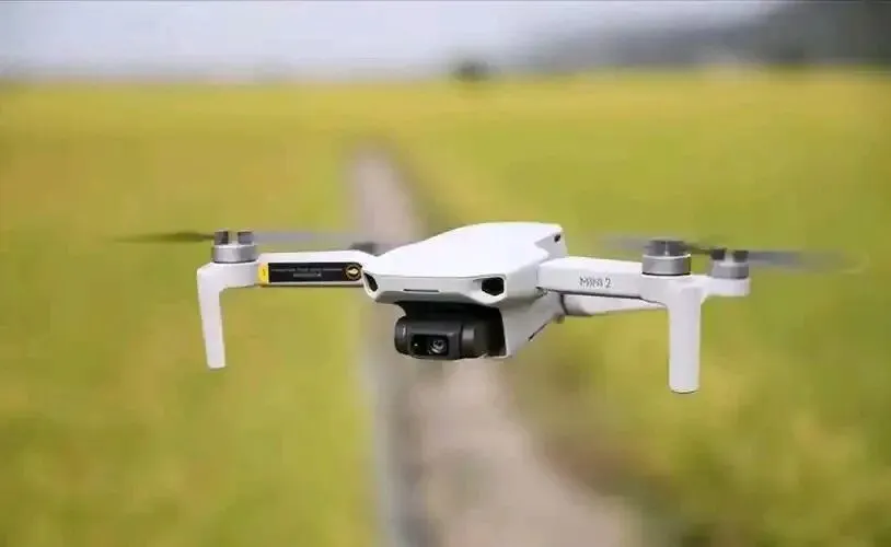
小型无人机(7kg<P≤25kg)在载荷能力和续航时间之间取得良好平衡,适用于多种救援场景。大疆Matrice 4系列属于这一类别,其中Matrice 4T裸机重量1219克,最大起飞重量1420克,最大载重200克,最长飞行时间49分钟。
Small UAVs (7kg < P ≤ 25kg) achieve a good balance between payload capacity and endurance, making them suitable for a variety of rescue scenarios.
The DJI Matrice 4 series falls into this category. Among them, the Matrice 4T has a bare weight of 1.219 kg, a maximum take-off weight of 1.42 kg, a maximum payload of 0.2 kg, and a maximum flight time of 49 minutes.
中型无人机(25kg<P≤150kg)具有较强的载荷能力和续航能力,可搭载多种任务设备执行复杂任务。湖北为11个市州配发的中型复合翼无人机兼具长航时、大载荷与垂直起降优势,可同时搭载多种任务载荷 。
大型无人机(P>150kg)主要用于重型载荷投送和特殊任务,如大型设备运输、长距离物资投送等。航天时代飞鹏FP-985商载超2吨,腾盾D18最大载重1.8吨,航空工业"九天"大型通用无人机最大载重6吨,最大起飞重量16吨 。
Medium UAVs (25kg < P ≤ 150kg) feature strong payload and endurance capabilities, enabling them to carry various mission equipment to perform complex tasks. The medium-sized hybrid-wing UAVs distributed by Hubei to 11 prefecture-level cities boast the advantages of long endurance, heavy payload and vertical take-off and landing (VTOL), and can carry multiple mission payloads simultaneously.
Large UAVs (P > 150kg) are mainly used for heavy payload delivery and special missions, such as large equipment transportation and long-distance material delivery. The Aerospace Times Feipeng FP-985 has a commercial payload of over 2 tonnes; the Tengdun D18 has a maximum payload of 1.8 tonnes; and AVIC's "Jiutian" large general-purpose UAV has a maximum payload of 6 tonnes and a maximum take-off weight of 16 tonnes.
1.4 按功能用途分类的任务模块
应急救援无人机按功能用途分为7大类型,每个类型都有专门的技术要求和应用规范:
1.4 Mission Modules Classified by Function and Application
Emergency rescue UAVs are divided into seven major categories according to their functions and applications, each with specific technical requirements and application specifications:
侦察型无人机搭载高分辨率相机或红外成像设备,能够快速完成灾区的初步勘查工作,为后续救援行动提供详细的数据支持。Matrice 4T配备了三光相机系统(广角、中长焦、长焦),其中长焦相机视角15°,等效焦距168毫米,可实现远距离目标识别。
侦检型无人机主要用于环境监测和危险物质检测,搭载气体探测传感器、水质采样器等设备,快速检测灾害事故现场的有毒有害气体和环境污染情况。这类无人机在危化品事故处置中发挥关键作用。
Reconnaissance UAVs are equipped with high-resolution cameras or infrared imaging devices, enabling rapid preliminary survey of disaster-stricken areas and providing detailed data support for follow-up rescue operations. The Matrice 4T is fitted with a three-light camera system (wide-angle, medium telephoto, telephoto), among which the telephoto camera has a 15° field of view and an equivalent focal length of 168mm, allowing long-distance target identification.
Detection UAVs are mainly used for environmental monitoring and hazardous substance detection. Carrying equipment such as gas detection sensors and water quality samplers, they can quickly detect toxic and harmful gases and environmental pollution at disaster accident sites. Such UAVs play a critical role in the disposal of hazardous chemical accidents.
通信型无人机作为空中通信基站,在通信基础设施受损的情况下提供紧急通信服务。HC-541应急通信复合翼无人机搭载机载卫通设备、PDT集群基站、宽带自组网设备等,能够迅速搭建应急通信专网 。
Communication UAVs serve as aerial communication base stations, providing emergency communication services when communication infrastructure is damaged.
The HC-541 emergency communication hybrid-wing UAV is equipped with airborne satellite communication equipment, PDT trunking base stations, broadband ad hoc network devices and other systems, enabling rapid establishment of an emergency private communication network.
广播型无人机搭载喊话器等设备,用于现场指挥、人员疏导和安全知识传播。在灾害现场,广播型无人机可向被困人员传达救援指令,稳定情绪,指导自救。
Loudspeaker UAVs are equipped with megaphones and other devices for on-site command, personnel evacuation and dissemination of safety knowledge.
At disaster scenes, such UAVs can transmit rescue instructions to trapped people, calm their emotions and guide self-rescue.
照明型无人机搭载大功率照明设备,保障夜间救援作业的顺利进行。系留式无人机可提供持续的高强度照明,有效提升夜间救援效率。
Illumination UAVs are equipped with high-power lighting equipment to ensure the smooth progress of rescue operations at night.
Tethered UAVs can provide sustained high-intensity illumination, effectively improving the efficiency of night rescue.
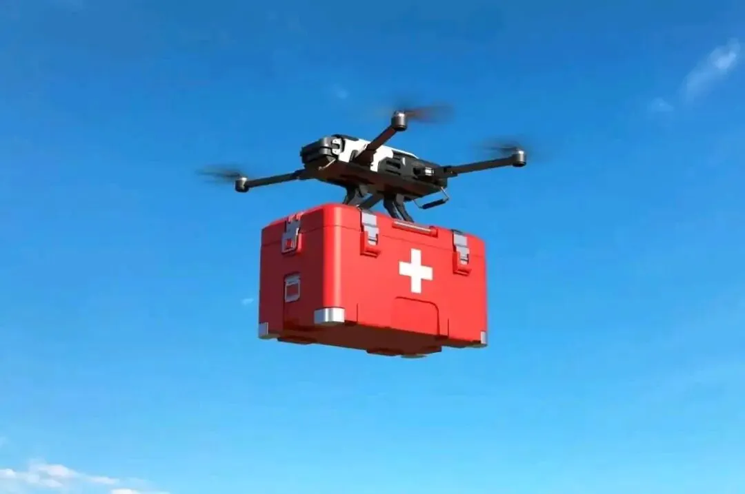
投送型无人机负责将医疗物资、食物、水等必需品快速送达灾区,减少人员直接参与运输的风险。大疆FlyCart 30等载重无人机可精准投掷灭火弹压制初期火势,并通过空吊系统运输水泵、水枪等重型装备 。
Delivery UAVs are responsible for rapidly delivering necessities such as medical supplies, food and water to disaster-stricken areas, reducing risks associated with direct human transportation.
Heavy-lift UAVs including the DJI FlyCart 30 can accurately drop fire-extinguishing projectiles to suppress early-stage fires, and transport heavy equipment such as water pumps and water guns via aerial hoisting systems.
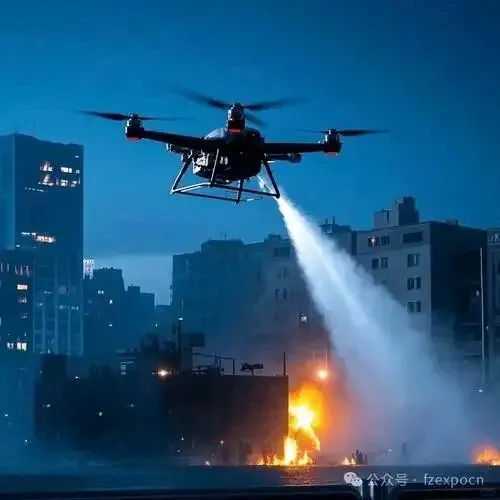
灭火型无人机搭载灭火弹、高压水枪等设备,执行空中灭火任务。涵道风扇推进技术的应用使无人机有效载荷达400公斤,可搭载65毫米或50毫米大口径水带喷水,形成持续性大流量灭火水流 。
Fire-fighting UAVs are equipped with fire-extinguishing projectiles, high-pressure water guns and other equipment to perform aerial fire suppression missions.
The application of ducted fan propulsion technology enables the UAV to achieve a payload of 400 kg. It can be fitted with 65mm or 50mm large-diameter water hoses to deliver a sustained, high-flow fire-fighting water stream.
二、技术研发前沿与创新突破
II. Cutting-Edge Technological R&D and Innovative Breakthroughs
2.1 人工智能技术的深度融合
人工智能技术正在重塑应急救援无人机的智能化水平,实现了从辅助工具向智能作业体的转型。通过内置目标检测AI模型、开放机载算力接口,无人机可在复杂场景下实现快速目标识别、大范围密度分析及实时数据处理。
2.2 Deep Integration of Artificial Intelligence Technology
Artificial intelligence technology is reshaping the intelligence level of emergency rescue UAVs, enabling their transformation from auxiliary tools to intelligent operational units. Through built-in AI target detection models and open onboard computing power interfaces, UAVs can achieve rapid target recognition, wide-area density analysis, and real-time data processing in complex scenarios.
在目标识别方面,AI算法通过分析可见光画面的烟雾形态、颜色扩散,结合热成像的明火特征、温度阈值,精准判别火情性质,误报率降低90%以上 。天津大学无人机学院研发的低空智能感知系统,通过多光谱传感器与AI算法融合,可在浓烟、暴雨中精准识别生命体征与火源位置,误判率下降92% 。在路径规划方面,基于强化学习的分布式决策框架使百架无人机编队可自主避障并动态重组路径,响应速度较传统方法提升40% 。融合气象雷达与IMU数据的AI动态调整技术,可在强风或雨雾中保持定位精度,水平误差小于0.1米 。在集群协同方面,大疆创新最新公布的1000+节点协同控制系统,通过分布式AI算法实现了固定翼、多旋翼、无人直升机等异构平台的实时任务分配。传统同构集群只能执行预设航线,而异构系统通过边缘节点实时计算,可根据设备特性自动分配任务,使作业效率提升400%,同时将单架次能耗降低18%。
2.1 Deep Integration of Artificial Intelligence Technology
In terms of target recognition, AI algorithms accurately identify fire characteristics by analyzing smoke shape and color diffusion in visible light images, combined with open flame features and temperature thresholds from thermal imaging, reducing false alarm rates by more than 90%.
The low-altitude intelligent perception system developed by the School of Unmanned Aerial Vehicles at Tianjin University integrates multispectral sensors with AI algorithms, enabling accurate identification of vital signs and fire locations even in heavy smoke and rainstorms, with a 92% drop in misjudgment rate.
In path planning, the distributed decision-making framework based on reinforcement learning allows formations of hundreds of UAVs to autonomously avoid obstacles and dynamically restructure routes, improving response speed by 40% compared with traditional methods.
AI dynamic adjustment technology integrating weather radar and IMU data maintains positioning accuracy in strong winds, rain or fog, with a horizontal error of less than 0.1 meters.
In swarm collaboration, DJI's newly released collaborative control system for over 1,000 nodes uses distributed AI algorithms to realize real-time task allocation for heterogeneous platforms including fixed-wing, multi-rotor and unmanned helicopters.
Traditional homogeneous swarms can only execute pre-set routes, whereas heterogeneous systems perform real-time computing through edge nodes and automatically assign tasks according to equipment characteristics, boosting operation efficiency by 400% and reducing single-sortie energy consumption by 18%.
2.2 通信技术的革命性突破
通信技术的创新为应急救援无人机在极端环境下的稳定作业提供了可靠保障。2025年3月,"翼龙"应急型无人机成功完成全国首次广电5G 700MHz空中应急通信基站测试,应急通信综合性能达常规方案2至3倍 。700MHz频段被称为"黄金频段",其覆盖半径是其他高频段的2-3倍,穿透力强且组网成本降低50% 。在广东省江门市的试飞中,无人机在4千米高空实现72平方公里信号覆盖,RSRP达-92dBm,语音短信全程稳定 。这一技术突破为解决灾后地面通信"三断"难题提供了有效方案。5G-UWB融合通信技术的应用实现了超低延迟通信。深圳实验室数据显示,5G-UWB融合通信链路在100架无人机同时接入时,延迟稳定在9ms,负载均衡度达91.7%。华为发布的"空天智联"系统通过5G-A网络实现1000架级无人机的毫秒级同步,通信时延控制在8ms以内,支持超视距飞行。卫星通信技术为远洋和偏远地区的应急救援提供了全球覆盖能力。搭载机载卫通设备的无人机可在无地面通信基础设施的环境下建立通信链路,确保救援指令的及时传达和现场信息的实时回传。
2.2 Revolutionary Breakthroughs in Communication Technology
Innovations in communication technology provide reliable guarantees for the stable operation of emergency rescue UAVs in extreme environments.
In March 2025, the Wing Loong emergency-configured UAV successfully completed China’s first test of a 5G 700MHz aerial emergency communication base station for radio and television, with comprehensive emergency communication performance reaching 2 to 3 times that of conventional solutions.
The 700MHz band is known as the "golden frequency band": its coverage radius is 2–3 times that of other high-frequency bands, it features strong penetration capability, and network construction costs are reduced by 50%.
In a test flight in Jiangmen, Guangdong Province, the UAV achieved signal coverage of 72 square kilometers at an altitude of 4 kilometers, with an RSRP of -92dBm and stable voice and short-message services throughout.
This technological breakthrough offers an effective solution to the "three disruptions" of ground communication after disasters.
The application of 5G-UWB integrated communication technology has realized ultra-low latency communication.
Data from a Shenzhen laboratory shows that with 100 UAVs accessing simultaneously, the 5G-UWB integrated communication link maintains a stable latency of 9ms and a load balancing rate of 91.7%.
Huawei’s released "Space-Air Intelligent Connection" system realizes millisecond-level synchronization for thousands of UAVs via 5G-A networks, with communication latency controlled within 8ms, supporting beyond-visual-line-of-sight flight.
Satellite communication technology provides global coverage for emergency rescue in oceanic and remote areas.
UAVs equipped with airborne satellite communication equipment can establish communication links in environments without ground communication infrastructure, ensuring timely delivery of rescue instructions and real-time transmission of on-site information.

2.3 传感器技术的多维融合
传感器技术的进步显著提升了无人机在复杂环境下的感知能力。现代应急救援无人机普遍采用多传感器融合技术,集成可见光相机、红外热成像仪、激光雷达、毫米波雷达等多种探测设备。在成像技术方面,最新的无人机搭载高光谱相机(400-2500nm)和激光雷达(点云密度200万/秒),可见光分辨率达0.5cm@100m,热成像温差灵敏度达0.1℃ 。Matrice 4T配备的红外热像仪分辨率达1280×1024(超分开启),红外波长8-14μm,测温精度高增益模式下为±2℃或±2%。在避障技术方面,双目视觉+ToF激光雷达构成的"六维避障系统",使无人机在复杂环境中的碰撞概率从1.2%降至0.03% 。全向双目视觉系统辅以机身底部三维红外传感器,前视和后视测距范围达0.4-22.5米,可探测范围0.4-200米,有效避障速度≤21米/秒。在环境感知方面,无人机搭载的温湿度传感器、气压计、多光谱成像仪及微型气象站,可实时采集大气温度、风速风向、气溶胶浓度及云层演变数据。在2024年湖北低温雨雪冰冻灾害救援中,无人机实时采集的气象数据为除雪行动和指挥调度提供了准确依据。
2.3 Multidimensional Fusion of Sensor Technology
Advancements in sensor technology have significantly improved the perception capability of UAVs in complex environments. Modern emergency rescue UAVs generally adopt multi-sensor fusion technology, integrating various detection equipment such as visible-light cameras, infrared thermal imagers, LiDAR, and millimeter-wave radars.
In terms of imaging technology, the latest UAVs are equipped with hyperspectral cameras (400–2500 nm) and LiDAR (point cloud density 2 million points/sec), with visible-light resolution reaching 0.5 cm@100 m and thermal imaging temperature difference sensitivity of 0.1 °C.
The infrared thermal imager equipped on the Matrice 4T features a resolution of 1280×1024 (with super-resolution enabled), an infrared wavelength of 8–14 μm, and a temperature measurement accuracy of ±2 °C or ±2% in high-gain mode.
In obstacle avoidance technology, the "six-dimensional obstacle avoidance system" composed of binocular vision and ToF LiDAR has reduced the collision probability of UAVs in complex environments from 1.2% to 0.03%.
The omnidirectional binocular vision system, supplemented by three-dimensional infrared sensors on the bottom of the airframe, has a forward and backward ranging range of 0.4–22.5 meters, a detectable range of 0.4–200 meters, and an effective obstacle avoidance speed of ≤21 m/s.
In environmental perception, UAVs equipped with temperature and humidity sensors, barometers, multispectral imagers, and mini weather stations can collect real-time data on atmospheric temperature, wind speed and direction, aerosol concentration, and cloud evolution.
During the rescue operations for the low-temperature rain, snow and freezing disaster in Hubei in 2024, the real-time meteorological data collected by UAVs provided an accurate basis for snow removal operations and command and dispatch.
2.4 动力系统的革新突破
动力系统技术的进步直接决定了无人机的续航能力和作业效率。当前,电池技术、氢燃料电池技术和混合动力技术正在并行发展,为不同应用场景提供最优解决方案。在电池技术方面,高比能宽温域锂电池能量密度突破400Wh/kg,让无人机续航提升20%-40%,即便在零下40℃至60℃的极端环境中也能稳定作业,最长滞空时间已达3小时。万向一二三发布的天距电池以860Wh/kg的单电芯能量密度突破行业极限,将无人机续航时间从40分钟延长至100分钟 。在氢燃料电池技术方面,北京航空航天大学研制的"天目山一号"无人机创造了氢燃料电池驱动的多旋翼无人机飞行最长距离世界纪录,用时4小时17分55秒,成功完成不间断飞行188.605公里,最大载荷能力6kg 。液氢动力系统的能量密度达到传统航空燃油的三倍,使无人机单次续航轻松超过1000公里 。在混合动力技术方面,FC-30型复合翼氢动力无人机使用高功率密度航空钛合金空冷氢燃料电池、12L高压氢瓶,翼展3.8米,最大起飞重量超40kg,有效载荷7kg,续航时间超4小时,环境运行温度零下20℃至65℃ 。这种混合动力系统结合了氢燃料电池的高能量密度和锂电池的高功率密度优势。在极端环境适应性方面,大连化物所研发的高比能锂电池通过自适应热管理技术与低温阻抗优化设计,将电池在-40℃低温环境下的续航里程衰减率控制在不足常温状态的10%,远低于行业平均水平的30%至50% 。封闭式复合冷却电池系统可在-40℃极寒到45℃高温环境下稳定工作,燃料电池寿命长达3000小时 。
2.4 Innovative Breakthroughs in Power Systems
Advancements in power system technologies directly determine the endurance and operational efficiency of UAVs. At present, battery technology, hydrogen fuel cell technology and hybrid power technology are developing in parallel, providing optimal solutions for different application scenarios.
In terms of battery technology, high-specific-energy wide-temperature lithium batteries have achieved an energy density of over 400Wh/kg, extending UAV endurance by 20%–40%. They can operate stably even in extreme environments ranging from -40°C to 60°C, with a maximum flight duration of up to 3 hours.
The Tianju battery released by FARASIS ENERGY has broken industry limits with a single-cell energy density of 860Wh/kg, extending UAV flight time from 40 minutes to 100 minutes.
In terms of hydrogen fuel cell technology, the Tianmushan No.1 UAV developed by Beihang University (Beijing University of Aeronautics and Astronautics) has set a world record for the longest flight distance of a hydrogen fuel cell-powered multi-rotor UAV. It completed a non-stop flight of 188.605 kilometers in 4 hours 17 minutes 55 seconds, with a maximum payload capacity of 6 kg.
Liquid hydrogen power systems offer three times the energy density of conventional aviation fuel, enabling UAVs to easily exceed 1,000 kilometers on a single flight.
In terms of hybrid power technology, the FC-30 hybrid-wing hydrogen-powered UAV adopts a high-power-density aeronautical titanium alloy air-cooled hydrogen fuel cell and a 12L high-pressure hydrogen cylinder. It has a wingspan of 3.8 meters, a maximum take-off weight of over 40 kg, an effective payload of 7 kg, an endurance of more than 4 hours, and an operating temperature range of -20°C to 65°C.
This hybrid system combines the high energy density of hydrogen fuel cells with the high power density of lithium batteries.
In terms of extreme environmental adaptability, the high-specific-energy lithium battery developed by the Dalian Institute of Chemical Physics adopts adaptive thermal management technology and optimized low-temperature impedance design. It limits the endurance degradation rate to less than 10% of the normal-temperature level at -40°C, far below the industry average of 30%–50%.
The enclosed combined cooling battery system can operate reliably from extreme cold at -40°C up to 45°C.
2.5 载荷技术的创新发展
载荷技术的进步使无人机能够执行更加复杂多样的救援任务。从简单的物资投送到精准的灭火作业,载荷技术正在向智能化、模块化、高效化方向发展。在灭火技术方面,涵道风扇推进技术实现了重大突破,桨盘载荷是传统旋翼的5-10倍,有效载荷达400公斤,起飞重量达800公斤。"敖钦"系统依托涵道风扇技术可搭载65毫米或50毫米大口径水带喷水,形成持续性大流量灭火水流 。玮航科技的涵道风扇灭火无人机系统涵道风扇额定推力达100公斤,峰值推力200公斤,有效载荷250-400公斤,于2025年7月18日成功获得国家消防装备检验检测中心认证,成为全国首个完成取证的大载荷系留供电供液消防灭火无人机。在物资投送技术方面,无人机投送系统的精度和效率不断提升。航天飞鹏联合苏州大学研发的大型无人机重载动态空投系统,单件货物重达400kg,至多载重4件重达2吨货物,可在5分钟内适应从-40℃到+50℃的快速温变环境,在180km/h飞行速度下完成投送 。在模块化设计方面,无人机载荷系统采用标准化接口,可根据任务需求快速更换不同功能模块。大载重消防运载无人机的机身搭载标准化专用设备接口,可根据高层建筑、山林火灾等不同救援场景,灵活切换消防水枪、消防水桶、抛投器等装备,针对高层灭火场景配备的40毫米消防水枪最大抬升高度可达100米 。
2.5 Innovative Development of Payload Technolog
Advancements in payload technology have enabled UAVs to perform more complex and diverse rescue missions. From simple material delivery to precise fire suppression, payload technology is evolving toward intelligence, modularization and high efficiency.
In terms of fire suppression technology, major breakthroughs have been made in ducted fan propulsion. Its disc load is 5–10 times that of traditional rotors, with a payload capacity of 400 kg and a take-off weight of 800 kg.
Based on ducted fan technology, the Aoqin System can be equipped with 65 mm or 50 mm large‑diameter water hoses to deliver a sustained high‑flow fire‑fighting water stream
Weihang Technology’s ducted fan fire‑fighting UAV system has a rated thrust of 100 kg and peak thrust of 200 kg, with an effective payload of 250–400 kg.
On July 18, 2025, it was officially certified by the National Fire Equipment Inspection and Testing Center, becoming China’s first certified large‑payload tethered fire‑fighting UAV for power and liquid supply.
In material delivery technology, the accuracy and efficiency of UAV delivery systems continue to improve.
The heavy‑load dynamic airdrop system for large UAVs, jointly developed by Aerospace Feipeng and Soochow University, can carry a single piece of cargo up to 400 kg, with a maximum total load of 2 tons for 4 pieces.
It can adapt to rapid temperature changes from ‑40°C to +50°C within 5 minutes and complete delivery at a flight speed of 180 km/h.
In terms of modular design, UAV payload systems adopt standardized interfaces, allowing quick replacement of functional modules according to mission requirements.
The airframe of heavy‑load fire‑fighting transport UAVs is equipped with standardized special‑purpose interfaces, enabling flexible switching between water cannons, water buckets, throwers and other equipment for different scenarios such as high‑rise buildings and mountain forest fires.
The 40 mm fire water cannon configured for high‑rise fire suppression can reach a maximum lifting height of 100 meters.
三、采购决策支撑与成本效益分析
III. Procurement Decision Support and Cost-Benefit Analysis
3.1 成本构成与价格体系
应急救援无人机的成本构成复杂,涵盖采购成本、维护成本、培训成本和运营成本等多个方面。了解完整的成本结构对于制定合理的采购决策至关重要。在采购成本方面,应急救援无人机价格跨度极大,从万元级到百万元级不等。入门级无人机如大疆Mini 3单机售价1299元,畅飞套装(含遥控器、三块电池)2299元 。消费级产品如大疆Mini 4售价1499元起,标准版3288元,长续航版可延长飞行时间至51分钟 。专业级产品价格明显提升,大疆Mavic 4 Pro售价13888元起,配备6K/60帧HDR视频与30公里O4+图传 。大型专业救援无人机价格更高,大疆FC100套装价格89999元起 。在政府采购项目中,价格差异更加明显:西乡县森林防灭火侦查无人机采购项目中标价1.1289万元 ;贵定县吊运无人机采购项目成交金额17.5万元;南平市危险化学品应急救援中心采购的华飞智能消防灭火无人机单价55万元,多用途侦检无人机单价22万元;安阳县无人机灭火救援综合装备采购项目预算高达650万元,包含无人机飞行平台、相关挂载装置、运输平台等一整套设备。在维护成本方面,无人机的维护费用相对较低。无人机采用电力驱动,免去了传统消防车高昂的燃油开销;结构相对简化,没有复杂的液压系统或重型底盘,维护更加简便。运维成本仅为云梯车的1/4,每飞行小时成本低于200元。某研究显示,一架应急救援无人机购置成本约10-20万元,每年维护、电池更换等费用约2-3万元 。在培训成本方面,无人机操作员的培训周期短、成本低。专业救援无人机操作人员经过1-2个月培训即可上岗,而直升机需要专业飞行员和地面保障团队,培训成本和人力成本都远高于无人机 。根据《消防救援无人机操控员》团体标准,无人机操控员分为初级、中级、高级三个等级,初级可执行视距内基础任务,中级承担超视距及夜间作业,高级可指挥编队作战并制定救援预案 。
3.1 Cost Composition and Pricing System
The cost structure of emergency rescue UAVs is complex, covering procurement cost, maintenance cost, training cost, operation cost and other aspects. Understanding the complete cost structure is crucial to making rational procurement decisions.
In terms of procurement cost, the price range of emergency rescue UAVs is extremely wide, ranging from ten thousand yuan level to million yuan level.
Entry-level UAVs such as the DJI Mini 3 are priced at 1,299 RMB for the basic version, and 2,299 RMB for the Fly More Combo (including remote controller and three batteries).
Consumer-grade products such as the DJI Mini 4 start at 1,499 RMB, with the standard version at 3,288 RMB; the long-endurance version extends flight time to 51 minutes.
Professional-grade products show a significant price increase: the DJI Mavic 4 Pro starts at 13,888 RMB, equipped with 6K/60fps HDR video and 30km O4+ video transmission.
Large professional rescue UAVs are more expensive, with the DJI FC100 combo starting at 89,999 RMB.
Price differences are even more pronounced in government procurement projects:
- Xixiang County forest fire prevention and reconnaissance UAV procurement project: winning bid of 11,289 RMB
- Guiding County lifting UAV procurement project: transaction amount of 175,000 RMB
- Nanping City Hazardous Chemicals Emergency Rescue Center: Huafei Intelligent fire-fighting UAV at 550,000 RMB per unit, multi-purpose detection UAV at 220,000 RMB per unit
- Anyang County UAV fire-fighting and rescue integrated equipment procurement project: budget up to 6.5 million RMB, including a complete set of UAV flight platforms, supporting mounting devices, transport platforms and other equipment.
In terms of maintenance cost, the upkeep expense of UAVs is relatively low.
Electrically powered UAVs eliminate the high fuel costs of traditional fire engines; their simplified structure, without complex hydraulic systems or heavy chassis, makes maintenance more convenient.
Operation and maintenance cost is only 1/4 that of ladder trucks, with cost per flight hour below 200 RMB.
A study shows that the purchase cost of an emergency rescue UAV is about 100,000–200,000 RMB, with annual expenses for maintenance and battery replacement around 20,000–30,000 RMB.
In terms of training cost, the training period for UAV operators is short and low-cost.
Professional rescue UAV operators can be certified after 1–2 months of training, whereas helicopters require professional pilots and ground support teams, with much higher training and labor costs than UAVs.
According to the group standard Fire Rescue UAV Operators, UAV operators are classified into three levels: junior, intermediate and senior.
Junior operators perform basic visual-line-of-sight tasks; intermediate operators conduct beyond-visual-line-of-sight and night operations; senior operators command formation operations and formulate rescue plans.
3.2 性能评估指标体系
建立科学的性能评估指标体系是采购决策的核心依据。应急救援无人机的性能评估应涵盖多个维度,确保所选设备能够满足实际救援需求。在续航能力方面,不同类型无人机的续航表现差异显著。消费级无人机续航20-30分钟,工业级无人机续航45-65分钟(携带标准负载),专业级无人机续航可达60-120分钟(取决于载荷配置)。以大疆产品为例,Matrice 4系列最长飞行时间49分钟(常规桨叶),最长悬停时间42分钟,最大续航里程35公里。大疆M400加装负载后前飞续航可达59分钟,悬停时间53分钟,配合300W充电功率,仅需两块电池就能实现近乎无缝的作业循环 。在抗风能力方面,这是评估无人机在恶劣天气条件下作业能力的关键指标。消费级无人机抗风4-5级,工业级无人机抗风6-7级(12-15m/s),专业级无人机抗风能力更强,可抵御7级以上强风。根据技术标准,无人机起降阶段应能承受8m/s风速,飞行阶段应能承受11m/s风速且持续时间不少于1分钟 。在实际应用中,6级风(10.8-13.8m/s)是常见的作业标准,7级风(13.9-17.1m/s)为高要求标准 。在通信距离方面,专业无人机的通信能力不断提升。无干扰环境下,专业无人机控制距离可达8-25公里,图传距离可达15-30公里(专网)。大疆Matrice 4系列在无干扰、无遮挡环境下,FCC标准图传距离达25公里,CE/SRRC标准达12公里。在实际复杂环境中,都市中心约1.5-5公里,近郊县城约5-15公里,远郊/海边约15-25公里。在环境适应性方面,无人机需要在各种恶劣环境下稳定工作。工作温度范围一般为-10℃至50℃,部分高端产品可达-40℃至50℃,能够在海拔3500米以上稳定运行 。防护等级要求整机IP55,关键部件IP67,确保在雨雪、沙尘环境中正常工作 。在湿度方面,应能在湿度≤95%(无凝结)的环境下正常工作 。
3.2 Performance Evaluation Index System
Establishing a scientific performance evaluation index system is the core basis for procurement decisions. The performance evaluation of emergency rescue UAVs should cover multiple dimensions to ensure the selected equipment meets actual rescue needs.
In terms of endurance, there are significant differences among different types of UAVs. Consumer-grade UAVs last 20–30 minutes, industrial-grade UAVs last 45–65 minutes with standard payloads, and professional-grade UAVs can achieve 60–120 minutes depending on payload configuration.
Taking DJI products as examples, the Matrice 4 series has a maximum flight time of 49 minutes with standard propellers, a maximum hover time of 42 minutes, and a maximum range of 35 km.
The DJI M400 can maintain a forward flight endurance of up to 59 minutes and a hover time of 53 minutes with payload installed. Paired with 300W charging power, only two batteries enable nearly seamless operation cycles.
Wind resistance is a key indicator of operational capability in severe weather.
Consumer-grade UAVs withstand wind force 4–5, industrial-grade UAVs resist force 6–7 (12–15 m/s), and professional-grade models can endure stronger winds above force 7.
According to technical standards, UAVs should tolerate 8 m/s wind during takeoff and landing, and 11 m/s for at least 1 minute during flight.
In practice, wind force 6 (10.8–13.8 m/s) is a common operational standard, while force 7 (13.9–17.1 m/s) represents a high-demand standard.
In terms of communication distance, the transmission capability of professional UAVs has been continuously improved.
In interference-free environments, the control range of professional UAVs can reach 8–25 km, and video transmission distance can reach 15–30 km over private networks.
The DJI Matrice 4 series achieves an FCC-standard video transmission distance of 25 km and 12 km under CE/SRRC standards in unobstructed, interference-free environments.
In complex real-world environments, the effective distance is about 1.5–5 km in urban centers, 5–15 km in suburban counties, and 15–25 km in remote or coastal areas.
For environmental adaptability, UAVs must operate stably in harsh conditions.
The typical operating temperature range is -10°C to 50°C, with some high-end models supporting -40°C to 50°C and stable operation above 3,500 meters altitude.
The protection rating requires an overall IP55 rating and IP67 for key components to ensure reliable performance in rain, snow, and dust.
In terms of humidity, UAVs should function normally at ≤95% relative humidity without condensation.
3.3 供应商格局与产品对比
中国应急救援无人机市场呈现"头部引领、多元竞争"的格局,消费级巨头与专业工业级厂商共同主导市场。了解主要供应商的技术特点和产品优势,有助于做出最优采购决策。在市场份额方面,大疆创新在消费级市场占据60%以上份额,在应急救援领域也处于领先地位 。龙翼航空在高层消防、物资运输等12个领域的全国市场占有率达50%,灭火弹全国市场占有率达75%以上 。中国在全球消防无人机市场中占据30%以上份额,2025年生产端市场份额达25.3%,预计2032年将提升至37.8% 。主要供应商的技术特点各有侧重。大疆创新以AI赋能全场景救援为特色,M4系列搭载智能目标检测系统,FC100载重80kg,构建空地一体化应急网络,"救在身边"项目覆盖全国2800乡镇。联合飞机是无人直升机领域的领军者,TD550载重200kg,首创"三断"环境通信中继技术,铂影T1400可化身"空中120"转运伤员。远度无人机采用复合翼+多旋翼双技术路线,ZT-120V能搜索2560个手机信号定位受困者,QD-640ER可挂载灭火弹实现"打早打小",系留无人机可72小时滞空监控。纵横股份在垂直起降固定翼技术方面领先,云龙系列大载重长航时,CW-100应急通信无人机年中标额超2亿元,AI算法使灾情评估效率提升4倍。重庆国飞全球首创"灭火无人机"概念,产品一分钟可扑灭100立方米高层大火,填补高层灭火世界空白。航天国器依托航天技术赋能,GQ-580Z/GQ-1600系列无人直升机在8-10级强风中稳定作业,构建空地一体应急指挥网。
3.3 Supplier Landscape and Product Comparison
China’s emergency rescue UAV market features a pattern of “leaders driving diversified competition”, with consumer-grade giants and professional industrial manufacturers jointly dominating the market. Understanding the technical characteristics and product strengths of major suppliers helps to make optimal procurement decisions.
In terms of market share:
- DJI holds over 60% of the consumer-grade market and is also a leader in the emergency rescue sector.
- Longyi Aviation accounts for 50% of China’s national market across 12 fields including high-rise fire fighting and material transport, and over 75% of the national market for fire extinguishing projectiles.
- China takes up more than 30% of the global fire-fighting UAV market, with a 25.3% production-side share in 2025, projected to rise to 37.8% by 2032.
Major suppliers focus on different technical strengths:
- DJI features AI-enabled full-scenario rescue. The M4 series is equipped with an intelligent target detection system; the FC100 has an 80kg payload capacity, supporting an air-ground integrated emergency network. Its “Rescue Around You” program covers 2,800 towns nationwide.
- United Aviation is a leader in unmanned helicopters. The TD550 carries a 200kg payload and pioneered communication relay technology in “three disruptions” environments. The Platinum Shadow T1400 can act as an “aerial ambulance” for casualty transport.
- Yuandu UAV adopts a dual technical route of hybrid wing + multi-rotor. The ZT-120V can search 2,560 mobile phone signals to locate trapped people; the QD-640ER can carry fire extinguishing projectiles for early fire suppression; tethered UAVs enable 72-hour hovering monitoring.
- ZHONGAN Aircraft excels in VTOL fixed-wing technology. The Yunlong series features heavy payload and long endurance; the CW-100 emergency communication UAV has an annual bid amount exceeding 200 million yuan, and its AI algorithm improves disaster assessment efficiency by four times.
- Chongqing Guofei pioneered the “fire-fighting UAV” concept worldwide. Its product can extinguish a 100-cubic-meter high-rise fire within one minute, filling a global gap in high-rise fire suppression.
- Aerospace Guoqi leverages aerospace technology. Its GQ-580Z/GQ-1600 series unmanned helicopters operate stably in Force 8–10 strong winds, establishing an air-ground integrated emergency command network.
3.4 投资回报率与经济效益分析
投资回报率(ROI)分析是评估无人机采购价值的重要手段。大量实践数据表明,无人机在应急救援中的应用能够带来显著的经济和社会效益。
在成本节约方面,无人机展现出巨大优势。运营成本仅为直升机的1/10-1/20,运输成本降低80%以上 。无人机巡检单公里成本约80元,较人工巡检(200元/公里)下降60%,按年巡检100万公里计算,每年可节约人工成本1.2亿元。在AED配送应用中,使用无人机配送AED的成本比传统定点部署模式降低了90% 。
在效率提升方面,无人机带来了革命性改进。泸定地震救援数据显示,整体任务完成时间缩短37%,单机效率提升2.1倍,搜索效率提升20-50倍,救援队平均到达时间从45分钟缩短至18分钟 。在江苏南通男子落水事件中,无人机在无光条件下5分钟内锁定目标,救援响应效率提升92% 。广州无人机应急救援中心通过5G通感一体技术,实现10公里半径内16架无人机集群作业,指挥决策效率提升5倍 。
在人员安全方面,无人机显著降低了救援风险。2024东京湾油库爆燃事故案例显示,无人机救援使消防员进入高危区域次数从32次降为0次,冷却剂使用效率从45%提升至81%。某研究对比了传统消防体系与无人机增强体系的成本,人员伤亡损失从1.2亿元降至0.17亿元,降幅达85.8%;装备损耗费从6800万元降至3200万元,降幅52.9%;保险费用从950万元/年降至410万元/年,降幅56.8%。
在投资回报案例方面,深圳某化工园区投资3800万元部署无人机消防系统,首年即避免2.1亿元潜在损失,ROI达452%。武汉演练测算显示,单架次无人机可替代8名高喷队员+2台云梯车,综合灭火成本下降55%。这些数据充分证明了无人机在应急救援领域的巨大投资价值。
3.4 Return on Investment and Economic Benefit Analysis
Return on Investment (ROI) analysis is an important method to evaluate the value of UAV procurement. A large amount of practical data shows that the application of UAVs in emergency rescue can bring significant economic and social benefits.
In terms of cost savings, UAVs show great advantages.
Their operating cost is only 1/10 to 1/20 that of helicopters, and transportation costs are reduced by more than 80%.
The cost of UAV inspection is about 80 yuan per kilometer, a 60% decrease compared with manual inspection (200 yuan/km). Based on an annual inspection distance of 1 million kilometers, labor costs can be saved by 120 million yuan per year.
In AED delivery applications, the cost of delivering AEDs by UAV is 90% lower than the traditional fixed-point deployment model.
In terms of efficiency improvement, UAVs have brought revolutionary improvements.
Data from the Luding earthquake rescue shows that overall task completion time was shortened by 37%, single-machine efficiency increased by 2.1 times, search efficiency improved by 20–50 times, and the average arrival time of rescue teams was reduced from 45 minutes to 18 minutes.
In a man-overboard incident in Nantong, Jiangsu, a UAV locked onto the target within 5 minutes in zero-light conditions, improving rescue response efficiency by 92%.
The Guangzhou UAV Emergency Rescue Center adopted 5G integrated communication and sensing technology to realize cluster operations of 16 UAVs within a 10-kilometer radius, raising command and decision-making efficiency by 5 times.
In terms of personnel safety, UAVs significantly reduce rescue risks.
A case study of the 2024 Tokyo Bay oil depot deflagration accident shows that UAV rescue reduced the number of firefighters entering high-risk areas from 32 to zero, and improved coolant utilization efficiency from 45% to 81%.
A study compared the costs of traditional fire protection systems and UAV-enhanced systems:
- Casualty losses decreased from 120 million yuan to 17 million yuan, a drop of 85.8%;
- Equipment wear and tear costs fell from 68 million yuan to 32 million yuan, a decrease of 52.9%;
- Insurance expenses dropped from 9.5 million yuan/year to 4.1 million yuan/year, a reduction of 56.8%.
In terms of investment return cases:
- A chemical industrial park in Shenzhen invested 38 million yuan in deploying a UAV fire protection system, avoiding 210 million yuan in potential losses in the first year, with an ROI of 452%.
- Calculations from a Wuhan drill show that one UAV sortie can replace 8 high-spray firefighters plus 2 ladder trucks, reducing the comprehensive fire extinguishing cost by 55%.
These data fully prove the huge investment value of UAVs in the field of emergency rescue.
四、应急响应规划与实战应用
IV. Emergency Response Planning and Practical Applications
4.1 灾害类型与无人机配置策略
不同类型的灾害对无人机配置有不同要求,科学的配置策略能够最大化发挥无人机在应急救援中的效能。根据灾害特点和救援需求,需要建立差异化的无人机配置方案。在地震救援中,无人机主要承担灾情侦察、人员搜救、物资投送和应急通信保障任务。新版《国家地震应急预案》系统纳入了大型固定翼无人机、通信中继无人机、空投卫星通信设备等低空应急救援力量,明确在断路、断网、断电场景中,调派大型固定翼长航时无人机开辟空中投送通道,使用弹射式中型侦察无人机、空投卫星电话,实现极端条件下信息穿透与群众一键呼救 。在云南消防跨区域地震救援演练中,曲靖支队采用无人机一机双控技术,30分钟内实现指挥部与所有搜救分队实时互联,利用长航时、大载重无人机完成物资抛投(30公斤)、激光打点测距、红外侦察、系留照明喊话、激光雷达建模等任务 。在洪水救援中,无人机的应用重点是人员搜救、物资投送和灾情监测。在2025年黄冈防汛抢险演练中,首次启用的无人飞行救生圈凭借快速响应、远程遥控、自动跟踪等技术优势,圆满完成模拟救援任务 。在河南省"应急使命-2025"防汛综合演练中,侦察无人机凭借高精度定位与360°实时观测,为救援方案绘制精准"作战图";搜救伤情检测无人机飞抵被困群众上空,通过搭载AI识别设备,对被困人员生命体征进行初步检测;挂载喊话器、应急照明等设备的无人机为后续救援行动提供支持 。在森林火灾救援中,无人机需要具备火情侦察、火势监测、灭火作业和物资投送等综合能力。宜昌市按照"3小时扑灭一起一般森林火灾"目标,针对三峡区域山坡、悬崖、峡谷等复杂地形地貌,演练了水箱洒水、抛投水袋、投掷灭火弹、挂载水带水枪四种战法 。在大兴安岭林业集团的"追雷行动"中,采用大、中、小无人机相互配合的方式,高、中、低空联合作业,靶向定位、精准核查,做到雷击火早发现、早处置 。在城市消防救援中,无人机重点解决高层建筑灭火难题。嘉兴市海宁市消防救援大队构建的"低空+地面"立体防控体系,58个无人机巢24小时值守高层建筑、工业园区、老旧小区和乡村防火区等重点区域,锚定"10分钟城乡灭火救援圈"目标 。山河星航系留无人机消防车可实现200米稳定灭火高度,覆盖90%以上的超高层建筑需求;"敖钦"系统每秒喷射流量超20升,有效射程突破40米;3500升/分钟的大流量喷射配合350公斤有效载荷,灭火效率远超常规无人机。
4.1 Disaster Types and UAV Configuration Strategies
Different types of disasters impose different requirements on UAV configuration. A scientific configuration strategy can maximize the effectiveness of UAVs in emergency rescue.
Differentiated UAV configuration plans should be established based on disaster characteristics and rescue needs.
In earthquake rescue, UAVs are mainly used for disaster reconnaissance, personnel search and rescue, material delivery, and emergency communication support.
The new version of the National Earthquake Emergency Plan systematically incorporates low-altitude emergency rescue forces such as large fixed-wing UAVs, communication relay UAVs, and airdrop satellite communication equipment. It clearly specifies that in road, network, and power outage scenarios, large fixed-wing long-endurance UAVs shall be deployed to open air delivery routes, and catapult-type medium reconnaissance UAVs and airdrop satellite phones shall be used to achieve information penetration and one-click calls for help under extreme conditions.
In a cross-regional earthquake rescue drill conducted by Yunnan Fire and Rescue Forces, the Qujing Detachment adopted dual-control UAV technology to realize real-time interconnection between the command headquarters and all search and rescue teams within 30 minutes. Long-endurance, heavy-lift UAVs were used to complete material delivery (30 kg), laser marking and ranging, infrared reconnaissance, tethered lighting and broadcasting, and LiDAR modeling.
In flood rescue, the focus of UAV application is on personnel search and rescue, material
4.2 多机协同作业模式
多机协同作业是提升应急救援效率的关键技术,通过合理的编队和任务分配,能够实现1+1>2的协同效应。当前,无人机协同技术正在向智能化、集群化方向快速发展。在集群协同技术方面,2025年深圳光明区山地救援现场,12架不同型号的无人机组成的异构集群在9毫秒内完成通信协同,将失联人员位置锁定在0.8米误差范围内,救援效率提升300%。传统救援中,单架无人机需要6小时才能完成10平方公里的搜索,而由3架固定翼长航时无人机与9架多旋翼侦察机构成的异构集群,仅用2小时就锁定目标。在空地协同模式方面,超视距空地协同指挥通信系统适配大疆Matrice 350RTK/300RTK无人机,地面救援单兵与无人机进入受灾区域,多机协同+超视距空地一体化组网,快速实现大范围覆盖。大疆M300无人机搭载机载电台飞行,利用空中中继实现超视距飞行,前端任务无人机对灾区进行大范围侦察,实时回传灾情画面,自动建立空地一体化指挥通信网络 。在跨域协同方面,神思智飞2.0支持空空、空地、空水等多类智能体之间的跨域协作,在互感互通的多模融合通讯能力支撑下,构建出具备"一呼百应、群策群力"特性的集群智慧。空空协同可根据任务需求自适应编组,提升搬运、通信与测绘等综合能力;空地与空水协同则实现了从无人机感知到机器狗、无人车、无人船等异构多域作业的行为闭环 。在实战应用案例方面,湖北18架无人机群在森林火灾救援中展现了卓越的协同能力。2架挂载50公斤水溶胶灭火弹的无人机飞抵火点上空5米处精准启爆,2架满载100公斤水的无人机实施垂直洒水,2架搭载150米水带的无人机在火线两侧构建空中水幕屏障。18架无人机形成网络:侦察机指引投弹机,投弹机为水幕机提供掩护,形成"定点控火+全域阻断"的多层次空中灭火网络 。
4.2 Multi-UAV Cooperative Operation Mode
Multi-UAV cooperative operation is a key technology to improve emergency rescue efficiency. Through reasonable formation and task allocation, a synergistic effect of 1+1>2 can be achieved. At present, UAV cooperation technology is developing rapidly toward intelligence and clustering.
In terms of swarm collaboration technology, at the mountain rescue site in Guangming District, Shenzhen, in 2025, a heterogeneous swarm composed of 12 drones of different models completed communication coordination within 9 milliseconds, locked the position of the missing person within an error range of 0.8 meters, and improved rescue efficiency by 300%.
In traditional rescue, a single drone takes 6 hours to search 10 square kilometers, while a heterogeneous swarm consisting of 3 fixed-wing long-endurance drones and 9 multi-rotor reconnaissance drones locked the target in only 2 hours.
In the air-ground coordination mode, the beyond-visual-range air-ground cooperative command and communication system is compatible with DJI Matrice 350 RTK/300 RTK UAVs.
Ground rescue personnel and drones enter the disaster-stricken area, and multi-machine coordination plus beyond-visual-range air-ground integrated networking rapidly achieves large-scale coverage.
The DJI M300 UAV flies with an airborne radio station and realizes beyond-visual-range flight through aerial relay. Front-end task drones conduct large-scale reconnaissance of the disaster area, transmit real-time disaster images, and automatically establish an air-ground integrated command and communication network.
In cross-domain collaboration, Shensi Smart Flight 2.0 supports cross-domain cooperation among multiple types of agents such as air-to-air, air-to-ground, and air-to-water. Supported by mutually sensing multi-mode fusion communication capabilities, it builds swarm intelligence with the characteristics of "rapid response and collective efforts".
Air-to-air coordination can adaptively form groups according to mission requirements to improve comprehensive capabilities such as transportation, communication, and mapping;
air-to-ground and air-to-water coordination realize a behavioral closed loop from UAV perception to heterogeneous multi-domain operations including robot dogs, unmanned vehicles, and unmanned ships.
In practical application cases, a swarm of 18 drones in Hubei demonstrated outstanding coordination capabilities in forest fire rescue.
Two drones carrying 50 kg hydrogel fire extinguishing bombs flew to 5 meters above the fire point for precise detonation;
two drones loaded with 100 kg of water carried out vertical sprinkling;
two drones equipped with 150-meter water hoses built an aerial water curtain barrier on both sides of the fire line.
The 18 drones formed a network: reconnaissance drones guided bombing drones, and bombing drones provided cover for water curtain drones, forming a multi-level aerial fire suppression network of "fixed-point fire control + global blocking".
4.3 指挥通信系统构建
高效的指挥通信系统是确保救援行动顺利进行的关键。现代应急救援无人机通过多层次、多手段的通信保障,构建了稳定可靠的指挥通信网络。在通信中继技术方面,无人机搭载的通信设备能够在"三断"环境下快速建立应急通信网络。HC-541应急通信复合翼无人机搭载机载卫通设备、机载PDT集群基站、机载宽带自组网设备等,为公安、应急等部门迅速搭建应急通信专网,实现指挥中心与一线搜救人员信息与指令实时互通 。在2025年"翼锋2025·新疆应急通信演练"中,航空应急救援队起飞中型复合翼无人机,搭载高清摄像头及传感器远程超低空侦察灾情,随后出动系留式无人机为该区域提供移动网络覆盖 。在指挥平台建设方面,现代应急救援建立了空地一体化的指挥体系。通过无人机+应急指挥通信车+卫星宽带通信,将火场视频图像实时传输至集团和所属林业局指挥中心,实现可视化指挥 。在中缅联合救灾行动中,中国资源卫星应用中心与无人机技术协同作战,构建起"空天一体"的灾情监测网络,卫星提供全局视角,无人机深入灾区核心区获取精准信息,展现了"空天协同"的独特优势 。在数据传输技术方面,无人机配备了高速、稳定的数据链路。大疆Matrice 4系列采用O4图传行业版,实时图传质量达1080p/30fps,最大下载速率20MB/s,延时130毫秒。在实际应用中,通过5G通信技术,无人机能够实时传输高清视频数据并进行现场决策支持,为指挥中心提供直观、准确的信息反馈。在通信安全保障方面,无人机通信系统采用了多重安全措施。包括自适应跳频技术在浓烟环境保持98.7%信号稳定度,网状网络(Mesh Network)在单机失联后0.3秒内自动重构通信链路。这些技术确保了在复杂电磁环境下通信的连续性和可靠性。
4.3 Command and Communication System
Building an efficient command and communication system is key to ensuring smooth rescue operations. Modern emergency rescue UAVs form a stable and reliable command and communication network through multi-level and multi-means communication support.
In terms of communication relay technology, communication equipment carried by UAVs can quickly establish an emergency communication network in "three disruptions" scenarios.
The HC-541 emergency communication hybrid-wing UAV is equipped with airborne satellite communication equipment, airborne PDT trunking base stations, airborne broadband ad hoc network devices, etc., to rapidly build an emergency communication private network for public security, emergency management and other departments, realizing real-time information and instruction interaction between the command center and frontline search and rescue personnel.
In the 2025 "Wing Blade 2025 · Xinjiang Emergency Communication Drill", the aviation emergency rescue team launched a medium-sized hybrid-wing UAV equipped with high-definition cameras and sensors for remote ultra-low-altitude disaster reconnaissance, then deployed tethered UAVs to provide mobile network coverage for the area.
In terms of command platform construction, modern emergency rescue has established an air-ground integrated command system.
Through UAVs + emergency command communication vehicles + satellite broadband communication, real-time video images of fire scenes are transmitted to the command centers of the group and its affiliated forestry bureaus, realizing visualized command.
In the China-Myanmar joint disaster relief operation, the China Centre for Resources Satellite Data and Application cooperated with UAV technology to build an "air-space integrated" disaster monitoring network. Satellites provided a global perspective, while UAVs penetrated the core disaster area to obtain accurate information, demonstrating the unique advantage of "air-space coordination".
In terms of data transmission technology, UAVs are equipped with high-speed and stable data links.
The DJI Matrice 4 series adopts the O4 video transmission industrial edition, with real-time video quality of 1080p/30fps, a maximum download rate of 20MB/s, and latency of 130 milliseconds.
In practical applications, 5G communication technology enables UAVs to transmit high-definition video data in real time and provide on-site decision support, delivering intuitive and accurate information feedback to the command center.
In terms of communication security support, UAV communication systems adopt multiple security measures,
including adaptive frequency hopping technology that maintains 98.7% signal stability in dense smoke environments, and mesh networks that automatically reconstruct communication links within 0.3 seconds after a single UAV loses connection.
These technologies ensure continuous and reliable communication in complex electromagnetic environments.
4.4 典型救援案例分析
通过分析近年来的典型救援案例,可以更好地理解无人机在实战中的应用效果和价值。这些案例涵盖了多种灾害类型和救援场景,展现了无人机技术的全面性和有效性。在洪涝灾害救援案例中,大疆M400无人机展现了卓越的性能。在一次暴雨灾害中,救援队迅速起飞搭载禅思H30T的大疆M400无人机执行全天候侦察任务,在3平方公里的受灾核心区,利用红外热成像功能仅用52分钟便精准锁定了3处被困人员聚集点。救援队首先利用无人机向被困点位精准空投了10部卫星电话,M400共计飞行15架次,实时航拍生成高清画面超1000张,仅用1小时便生成受灾现状图。在山地救援案例中,无人机的快速响应能力得到充分体现。在广东江门恩平河排森林公园3名人员迷路被困的救援中,救援小组进山救援过程中,无人机通过激光和探照灯引导行进路线,帮助被困人员成功获救。消防救援人员利用DJI Mavic 3T、经纬M30T等无人机,通过热成像相机在夜间快速搜索3公里河道,20分钟精准确认被困人员位置,随后Mavic 3T无人机搭载小型探照灯,引导冲锋舟10分钟成功到达目标点,将3名被困人员救出 。在森林火灾救援案例中,无人机的集群作战能力展现了强大威力。在2025年岳阳楼区森林防火演练中,军特智能携天眸航空K-50灭火无人机惊艳亮相,无人机携带两枚25公斤干粉或水基灭火弹,飞往"火源"上空悬停,激光雷达穿透烟雾锁定火源,在"火源"上方1-3米精准引爆灭火弹,压制400平米左右的"火势" 。在跨区域协同救援案例中,无人机展现了快速部署和协同作战能力。在兰溪市遭遇强降雨引发洪涝灾害的救援中,部分低洼村庄和路段被洪水淹没、道路中断,有行动不便的老人被困家中。金华公安启用警用无人机紧急驰援,利用无人机的高空视角快速锁定多处被困群众的具体位置,挂载着救生衣、食品包和药品的救援无人机根据指令飞抵受困点上空,在操作员精准操控下,将应急物资平稳、准确地投放给被困群众,稳定其情绪,为进一步救援赢得了时间 。
4.4 Typical Rescue Case Studies
By analyzing typical rescue cases in recent years, we can better understand the practical effects and value of UAVs in actual operations. These cases cover various disaster types and rescue scenarios, demonstrating the comprehensiveness and effectiveness of UAV technology.
In flood disaster rescue cases, the DJI M400 UAV showed outstanding performance.
During a heavy rain disaster, the rescue team quickly launched the DJI M400 equipped with a Zenmuse H30T for all-weather reconnaissance.
In the 3-square-kilometer core disaster area, it accurately located 3 trapped gathering points in only 52 minutes using infrared thermal imaging.
The rescue team first precisely airdropped 10 satellite phones to the trapped locations via UAV.
The M400 flew a total of 15 sorties, capturing over 1,000 high-definition real-time aerial images, and generated a disaster status map in just one hour.
In mountain rescue cases, the rapid response capability of UAVs was fully demonstrated.
During the rescue of three lost and trapped people in Hepai Forest Park, Enping, Jiangmen, Guangdong, the UAV guided the advance route with lasers and searchlights while the rescue team entered the mountain, helping the trapped persons escape successfully.
Firefighters used DJI Mavic 3T, Matrice M30T and other UAVs to quickly search a 3-kilometer river course at night with thermal imaging cameras, confirming the trapped persons’ precise location in 20 minutes.
The Mavic 3T then carried a small searchlight to guide the assault boat to the target successfully in 10 minutes, rescuing the three trapped people.
In forest fire rescue cases, the swarm combat capability of UAVs showed great power.
In the 2025 forest fire prevention drill in Yueyanglou District, Junte Intelligence and Tianmu Aviation’s K-50 fire-fighting UAV made a stunning appearance.
The UAV carried two 25-kilogram dry powder or water-based fire extinguishing projectiles, hovered above the fire source, used LiDAR to penetrate smoke and lock the fire source, and detonated the projectiles precisely 1–3 meters above the fire, suppressing a fire covering about 400 square meters.
In cross-regional coordinated rescue cases, UAVs demonstrated rapid deployment and joint operation capabilities.
During the flood rescue in Lanxi caused by heavy rainfall, some low-lying villages and roads were submerged and cut off, with elderly people with limited mobility trapped at home.
Jinhua police deployed police UAVs for emergency support, quickly locating multiple trapped groups from high altitude.
Rescue UAVs carrying life jackets, food packs and medicine flew to the trapped sites as instructed.
Under precise operator control, emergency supplies were delivered smoothly and accurately to the trapped people, stabilizing their emotions and buying time for further rescue.

五、适用条件与法规环境分析
V. Analysis of Applicable Conditions and Regulatory Environment
5.1 气候环境适应性要求
应急救援无人机需要在各种恶劣气候环境下稳定工作,对环境适应性有严格要求。了解不同环境条件对无人机性能的影响,对于制定合理的作业计划至关重要。在温度适应性方面,无人机的工作温度范围通常为-10℃至50℃,部分高端产品可达-40℃至50℃。锂电池的工作特性决定了温度对续航的显著影响,高温会让电池鼓包性能下降,低温直接导致掉电严重,续航可能减半。最适合的工作温度一般在20-30°C,冬天飞行前最好先给电池预热 。在实际应用中,无人机需要能够在海拔3500米以上稳定运行,这对发动机功率和电池性能都提出了更高要求 。在湿度适应性方面,无人机应能在湿度≤95%(无凝结)的环境下正常工作 。潮湿环境容易让电机电路板短路,刚下过雨的草地、海边等高湿度区域飞行风险较大 。沿海地区湿度≥85%时,需要缩短飞行时间(≤30分钟),飞行后立即清洁设备,防止盐雾腐蚀 。在风力适应性方面,不同级别的无人机有不同的抗风要求。消费级无人机飞行风速≤5级(≤10.7m/s),专业级≤7级(≤15.5m/s),遇阵风、雷暴预警应立即取消飞行 。根据技术标准,无人机起降阶段应能承受8m/s风速,飞行阶段应能承受11m/s风速且持续时间不少于1分钟 。在实际作业中,6级风是常见的作业标准,7级风为高要求标准,8级以上大风一般不建议飞行 。在特殊环境适应性方面,无人机还需要应对雨雪、沙尘等恶劣天气。无人机应达到IP54防护等级,确保在雨雪、沙尘环境中正常工作 。整机防护等级要求IP55,关键部件IP67,以应对极端环境挑战 。大雾、暴雨、沙尘等天气绝对禁止飞行,因为这些天气条件会严重影响无人机的导航和避障能力 。
5.1 Climatic Environmental Adaptability Requirements
Emergency rescue UAVs need to operate stably under various harsh climatic conditions and have strict requirements for environmental adaptability. Understanding how different environmental conditions affect UAV performance is crucial for developing reasonable operational plans.
In terms of temperature adaptability, the typical operating temperature range of UAVs is -10°C to 50°C, with some high-end models supporting -40°C to 50°C.
The performance of lithium batteries is highly temperature-dependent: high temperatures may cause battery swelling and performance degradation, while low temperatures directly lead to severe power drop and possible halving of endurance. The optimal operating temperature is generally 20–30°C, and batteries should be preheated before winter flights.
In practice, UAVs must operate stably above 3,500 meters altitude, which imposes higher requirements on engine power and battery performance.
In terms of humidity adaptability, UAVs should function normally under humidity ≤ 95% (non-condensing).
Humid environments can easily short-circuit motor circuit boards, posing high risks when flying over freshly rain-soaked grasslands, coastal areas, and other high-humidity zones.
In coastal areas with humidity ≥ 85%, flight time should be limited to ≤ 30 minutes, and equipment should be cleaned immediately after flight to prevent salt spray corrosion.
In terms of wind resistance, different classes of UAVs have different wind tolerance requirements.
Consumer-grade UAVs support wind speeds ≤ Force 5 (≤ 10.7 m/s), professional-grade ≤ Force 7 (≤ 15.5 m/s). Flights should be canceled immediately if gusts or thunderstorm warnings are issued.
According to technical standards, UAVs should withstand 8 m/s wind during takeoff and landing, and 11 m/s for at least 1 minute during flight.
In actual operations, Force 6 wind is a common operational standard, Force 7 is a high-demand standard, and flights are generally not recommended under Force 8 or stronger winds.
In terms of special environmental adaptability, UAVs must also cope with harsh weather such as rain, snow, and sand dust.
UAVs should meet at least IP54 protection rating to ensure normal operation in rain, snow, and dusty environments.
The whole machine is required to reach IP55 and key components IP67 to withstand extreme environmental challenges.
Flights are strictly prohibited in heavy fog, rainstorms, sandstorms, etc., as such conditions severely impair navigation and obstacle avoidance capabilities.
5.2 空域管理政策与飞行许可
空域管理政策是影响无人机应急救援应用的重要因素。随着无人机技术的快速发展,相关法规政策也在不断完善和更新。在分级管理政策方面,2025年12月实施的民用无人机新规建立了严格的分级管理制度。新规将无人机分为微型(<250克)、轻型(250克-4千克)、小型(4-150千克)和大型(>150千克)四类,对应不同的准入门槛。电子围栏全面升级,全国划设13.6万个禁飞区,包括救援现场周边5公里自动禁飞。操作资质分级管理,驾驶小型以上无人机需通过理论+实操考试,类似机动车驾照。在地方管理规定方面,各地纷纷出台具体的管理办法。山东省出台的《民用无人驾驶航空器公共安全管理办法》于2026年1月1日起施行,构建起常态化监管体系。2025年6月修订通过的新《中华人民共和国治安管理处罚法》于2026年1月1日起施行,首次将无人机"黑飞"明确列为妨害公共安全行为。大连市规定低空飞行活动应在空中交通管理机构划定的低空空域内进行,飞行计划需符合空中交通管理规则,避开军事禁区、重要设施上空等敏感区域 。在应急救援特殊政策方面,国家对紧急情况下的无人机应用给予了特殊支持。新版《国家地震应急预案》明确,在断路、断网、断电场景中,可调派大型固定翼长航时无人机开辟空中投送通道,使用弹射式中型侦察无人机、空投卫星电话等设备。这为应急救援无人机在特殊情况下的使用提供了政策保障 。在飞行许可要求方面,应急救援无人机的使用需要遵循相关程序。根据浙江省《民用无人机应急救援服务规范》,无人机应急救援应坚持合规管理原则,按规定申请划设和使用空域,接受飞行活动管理和空中交通管理。民用无人机操控员应按照《无人驾驶航空器飞行管理暂行条例》《民用无人驾驶航空器运行安全管理规则》的要求取得相应资质 。
5.2 Airspace Management Policies and Flight Permits
Airspace management policies are a critical factor affecting the application of UAVs in emergency rescue. With the rapid development of UAV technology, relevant regulations and policies are continuously being improved and updated .
Hierarchical Management Policies
New civil UAV regulations implemented in December 2025 established a strict hierarchical management system . The regulations categorize UAVs into four classes with corresponding access thresholds:
- Micro: <250g
- Light: 250g–4kg
- Small: 4–150kg
- Large: >150kg
Electronic geofences have been fully upgraded, with 136,000 no-fly zones designated nationwide, including automatic no-fly zones within 5km of rescue sites. Operator qualifications are managed hierarchically: piloting small and larger UAVs requires passing both theoretical and practical exams, similar to a motor vehicle license.
Local Management Regulations
Various regions have issued specific management measures:
- Shandong Province’s Measures for Public Safety Management of Civil Unmanned Aerial Vehicles came into force on January 1, 2026, establishing a normalized supervision system.
- The revised Law of the People’s Republic of China on Public Security Administration Punishments, adopted in June 2025 and effective January 1, 2026, for the first time explicitly classifies unapproved UAV flights (“black flights”) as acts endangering public safety.
- Dalian requires low-altitude flight activities to be conducted within airspace designated by air traffic management authorities, with flight plans complying with air traffic management rules and avoiding sensitive areas such as military restricted zones and important facilities
Special Policies for Emergency Rescue
The state provides special support for UAV applications in emergency situations. The new National Earthquake Emergency Response Plan clearly stipulates that in scenarios of road, network, and power outages (“three disruptions”), large fixed-wing long-endurance UAVs may be deployed to open aerial delivery channels, and catapult-type medium reconnaissance UAVs and air-dropped satellite phones may be used . This provides policy guarantees for the use of emergency rescue UAVs under special circumstances .
Flight Permit Requirements
The use of emergency rescue UAVs must follow relevant procedures. According to Zhejiang Province’s Specifications for Emergency Rescue Services of Civil Unmanned Aerial Vehicles, UAV emergency rescue shall adhere to the principle of compliance management, apply for and use airspace in accordance with regulations, and accept flight activity and air traffic management . Civil UAV operators shall obtain corresponding qualifications in accordance with the requirements of the Interim Regulation on the Administration of the Flight of Unmanned Aircraft and the Rules for the Safety Management of Civil Unmanned Aerial Vehicle Operations .

专业的操作人员是确保无人机安全高效作业的关键。应急救援无人机对操作人员的资质和技能有严格要求。在资质等级要求方面,《消防救援无人机操控员》团体标准构建了初、中、高三级职业能力体系。初级可执行视距内基础任务,中级承担超视距及夜间作业,高级可指挥编队作战并制定救援预案 。该标准将于2025年12月1日起正式实施,由福建省消防救援总队、中国消防救援学院、河南省猎鹰消防科技有限公司等单位编制 。在基本条件要求方面,无人机操作人员需要满足多项条件。年龄要求视距内/超视距驾驶员需满16周岁,教员需满18周岁;学历要求视距内/超视距驾驶员需初中及以上,教员需高中及以上;无犯罪记录要求视距内需3年内无记录,超视距及教员需5年内无记录;健康要求矫正视力1.0以上,无色盲色弱,无传染性疾病及精神类疾病 。在培训内容方面,无人机操作人员需要接受系统的培训。培训内容包括应急处置,涵盖信号丢失、电池故障等12类突发情景的标准化应对流程,要求学员掌握VR模拟器中的避障决策。教员资格要求在取得机长证后,完成100小时带教记录,并通过"教学能力评估" 。在技能要求方面,不同等级的操作人员有不同的能力要求。初级人员应能熟练操作无人机完成基本飞行任务,掌握目视飞行规则;中级人员应能在复杂环境下操作无人机,掌握仪表飞行规则,具备夜间飞行能力;高级人员应能指挥多机协同作业,制定救援方案,具备在极端条件下的决策能力。
5.3 Personnel Qualifications and Training Requirements
Professional operators are the key to ensuring the safe and efficient operation of UAVs. Emergency rescue UAVs impose strict requirements on the qualifications and skills of operators.
Qualification Level Requirements
The group standard Fire Rescue UAV Operators has established a three-level professional capability system: junior, intermediate, and senior.
- Junior operators can perform basic tasks within visual line of sight.
- Intermediate operators undertake beyond visual line of sight and night operations.
- Senior operators can command formation operations and formulate rescue plans.
This standard will be officially implemented on December 1, 2025, compiled by the Fujian Fire and Rescue Corps, China Fire and Rescue Institute, Henan Falcon Fire Technology Co., Ltd., and other institutions.
Basic Condition Requirements
UAV operators must meet multiple criteria:
- Age: at least 16 years old for visual / beyond visual line of sight pilots; at least 18 years old for instructors.
- Education: junior high school or above for pilots; senior high school or above for instructors.
- Criminal record: no record within 3 years for visual pilots; no record within 5 years for beyond visual line of sight pilots and instructors.
- Health: corrected visual acuity above 1.0, no color blindness or color weakness, no infectious diseases or mental illnesses.
Training Content Requirements
UAV operators must receive systematic training covering emergency response, including standardized procedures for 12 types of emergencies such as signal loss and battery failure. Trainees are required to master obstacle avoidance decision-making in VR simulators.
Instructor qualifications require obtaining a UAV commander certificate, completing 100 hours of supervised training records, and passing a "teaching ability assessment".
Skill Requirements
Different levels correspond to different capability standards:
- Junior operators shall proficiently conduct basic flights and master visual flight rules.
- Intermediate operators shall operate UAVs in complex environments, master instrument flight rules, and be capable of night flight.
- Senior operators shall command multi-UAV cooperative operations, develop rescue plans, and make decisions under extreme conditions.
5.4 维护保障体系建设
完善的维护保障体系是确保无人机持续可靠运行的基础。应急救援无人机的维护保障需要建立系统化、标准化的管理体系。在日常维护要求方面,无人机需要定期进行全面检查和保养。飞行前检查包括核对无人机、遥控终端、备用电源、传感器、摄录设备与载荷的完好性,明确载荷重量与平衡条件,清洁云台、GPS天线、避障传感器,检查机身密封是否完好。电池检查尤为重要,需要确认电量≥80%,鼓包、漏液电池严禁使用,专业级无人机需配备冗余电池 。在维护保养制度方面,需要建立严格的全生命周期管理体系。包括建立设备台账,记录保养、故障、部件更换及性能变化;准备关键易损件与备用设备,确保现场即可完成基本维护与快速替换;对雷达、通信天线等户外单元进行防冰冻包裹,定期巡检保温效果;柴油发电机、UPS电源等关键电力设备需配置防冻液并置于暖环境,执行定期试车验证。在应急保障机制方面,需要建立快速响应的故障处理体系。日常巡检要求每周安排技术人员对机库、无人机进行现场巡检,确保设备正常运行;备件储备要求在核心机库储备无人机电池、挂载设备备件,故障时快速更换;应急响应要求建立设备故障应急预案,4小时内完成现场维修或设备替换。在特殊环境维护方面,不同环境条件下有特殊的维护要求。在沿海地区,盐雾环境对设备腐蚀严重,需要特别注意清洁和防护。在高原地区,低气压和强紫外线对设备性能有影响,需要加强检查频次。在极寒地区,电池性能下降明显,需要采取保温措施。在技术支持体系方面,需要建立完善的技术保障网络。包括建立区域支持中心,提供技术援助和备件供应;与设备供应商建立长期合作关系,确保及时获得技术支持;建立操作人员培训体系,提升维护技能水平;建立设备性能监测系统,实时掌握设备运行状态。
5.4 Construction of Maintenance and Support System
A sound maintenance and support system is the foundation for ensuring the continuous and reliable operation of UAVs. A systematic and standardized management system is required for the maintenance and support of emergency rescue UAVs.
Routine Maintenance Requirements
UAVs need regular comprehensive inspections and maintenance.
Pre-flight checks include verifying the integrity of the UAV, remote terminal, backup power supply, sensors, recording equipment and payloads, confirming payload weight and balance conditions, cleaning the gimbal, GPS antenna and obstacle avoidance sensors, and inspecting the fuselage sealing.
Battery checks are particularly critical: the remaining power must be at least 80%; swollen or leaking batteries are strictly prohibited; professional UAVs shall be equipped with redundant batteries.
Maintenance System
A strict full-life-cycle management system shall be established, including:
- Setting up equipment ledgers to record maintenance, faults, component replacements and performance changes;
- Preparing key consumable parts and backup equipment to enable on-site basic maintenance and rapid replacement;
- Applying anti-freezing wrapping to outdoor units such as radars and communication antennas, with regular inspections of thermal insulation effects;
- Adding antifreeze to key power equipment such as diesel generators and UPS, placing them in warm environments, and conducting regular test runs.
Emergency Support Mechanism
A rapid-response fault handling system shall be established.
- Routine inspection: technicians shall conduct on-site inspections of hangars and UAVs weekly to ensure normal operation;
- Spare parts storage: UAV batteries and payload spare parts shall be stored in core hangars for quick replacement in case of failure;
- Emergency response: an equipment failure emergency plan shall be formulated to complete on-site repair or equipment replacement within 4 hours.
Special Environmental Maintenance
Special maintenance requirements apply under different environmental conditions.
- Coastal areas: severe salt spray corrosion requires enhanced cleaning and protection;
- Plateau areas: low air pressure and strong UV radiation affect equipment performance, requiring more frequent inspections;
- Extremely cold regions: significant battery performance degradation necessitates thermal insulation measures.
Technical Support System
A comprehensive technical support network shall be built, including:
- Establishing regional support centers to provide technical assistance and spare parts supply;
- Building long-term partnerships with equipment suppliers for timely technical support;
- Developing an operator training system to improve maintenance capabilities;
- Setting up an equipment performance monitoring system to track real-time operating status.
结语:发展趋势与战略建议
Conclusion: Development Trends and Strategic Recommendations
技术发展趋势展望
应急救援无人机技术正处于快速发展的关键时期,呈现出智能化、集群化、重载化、标准化的发展趋势。在智能化发展方面,人工智能技术的深度融合将使无人机从辅助工具向自主决策系统演进。通过深度学习算法优化决策路径规划和任务执行策略,无人机将具备更强的环境感知和自主决策能力。预计到2030年,具备完全自主决策能力的智能救援无人机将成为主流,能够在复杂环境下独立完成救援任务。在集群化发展方面,多机协同技术将实现更大规模的集群作业。随着通信技术和控制算法的进步,未来将实现数百架甚至上千架无人机的协同作业,形成"蜂群"式的救援能力。异构集群技术将使不同类型、不同功能的无人机实现无缝协同,最大化发挥各自优势。在重载化发展方面,大载荷、长航时无人机平台将成为技术攻关重点。随着氢燃料电池、混合动力等技术的成熟,无人机的载荷能力和续航时间将大幅提升。预计到2027年,载重超过500公斤、续航超过24小时的大型救援无人机将投入使用,能够承担更重型的救援任务。在标准化发展方面,随着行业的成熟,相关标准体系将不断完善。从技术标准到作业规范,从人员培训到资质认证,都将建立起完整的标准体系。这将促进产业健康发展,提升应急救援的整体效能。
Outlook on Technological Development Trends
Emergency rescue UAV technology is in a critical stage of rapid development, showing trends toward intelligence, clustering, heavy payload capability, and standardization.
In terms of intelligent development, the deep integration of artificial intelligence will enable UAVs to evolve from auxiliary tools into autonomous decision-making systems.
Through deep learning algorithms to optimize decision-making path planning and task execution strategies, UAVs will gain stronger environmental perception and autonomous decision-making capabilities.
It is expected that by 2030, intelligent rescue UAVs with full autonomous decision-making capabilities will become mainstream, able to independently complete rescue missions in complex environments.
In terms of clustering development, multi-UAV collaboration technology will enable large-scale swarm operations.
With advances in communication and control algorithms, future systems will support coordinated operations of hundreds or even thousands of UAVs, forming swarm-style rescue capabilities.
Heterogeneous swarm technology will allow seamless cooperation among UAVs of different types and functions, maximizing their respective advantages.
In terms of heavy-payload development, large-payload, long-endurance UAV platforms will become key technical priorities.
As hydrogen fuel cells, hybrid power and other technologies mature, payload capacity and flight endurance will be greatly improved.
It is projected that by 2027, large rescue UAVs with payloads exceeding 500 kg and endurance over 24 hours will be put into use, capable of undertaking heavier rescue tasks.
In terms of standardization development, as the industry matures, the relevant standard system will be continuously improved.
A complete framework will be established covering technical standards, operational specifications, personnel training and qualification certification.
This will promote the healthy development of the industry and enhance the overall effectiveness of emergency rescue.
战略建议
基于对应急救援无人机技术发展现状和趋势的分析,提出以下战略建议:对于政府部门:应加强顶层设计,制定应急救援无人机发展规划,明确发展目标和重点任务。加大政策支持力度,在空域管理、资金投入、标准制定等方面给予倾斜。建立跨部门协调机制,推动应急管理、公安、消防、医疗等部门的协同应用。加强基础设施建设,在重点区域布局无人机起降平台、充电设施、维护保障站点等。对于应急管理部门:应建立科学的装备配置体系,根据不同地区的灾害特点和救援需求,合理配置不同类型的无人机。加强人员培训,建立专业化的无人机救援队伍。完善应急预案,将无人机纳入应急救援体系,明确在不同灾害场景下的使用策略。加强实战演练,提升无人机在复杂环境下的作业能力。对于采购决策部门:应建立科学的评估体系,综合考虑技术性能、成本效益、维护保障等因素。采用"小批量试点、逐步推广"的策略,先在重点地区和关键场景进行试点应用。注重供应商的技术实力和服务能力,选择有持续创新能力和完善服务体系的企业合作。建立长期运维机制,确保设备的持续可靠运行。对于技术研发机构:应加强关键技术攻关,重点突破人工智能、新能源、通信技术等核心技术瓶颈。加强产学研合作,推动技术成果的快速转化和应用。注重标准体系建设,积极参与行业标准的制定。加强国际合作,学习借鉴国外先进技术和经验。对于产业发展:应推动产业生态建设,形成涵盖研发、制造、运营、服务的完整产业链。加强品牌建设,提升中国应急救援无人机的国际竞争力。注重可持续发展,在技术创新的同时关注环保和安全。加强人才培养,为产业发展提供智力支撑。应急救援无人机技术的发展不仅是技术进步的体现,更是人类应对自然灾害和突发事件能力提升的重要标志。随着技术的不断成熟和应用的不断深化,无人机将在应急救援领域发挥越来越重要的作用,为保护人民生命财产安全、维护社会稳定做出更大贡献。我们有理由相信,在各方共同努力下,应急救援无人机技术必将迎来更加辉煌的发展前景。
Strategic Recommendations
Based on an analysis of the current state and trends of emergency rescue UAV technology, the following strategic recommendations are proposed:
For government departments:
Strengthen top-level design, formulate development plans for emergency rescue UAVs, and clarify development goals and key tasks.
Increase policy support with favorable measures in airspace management, funding investment, and standard-setting.
Establish cross-departmental coordination mechanisms to promote collaborative applications among emergency management, public security, fire fighting, medical and other sectors.
Enhance infrastructure development by deploying UAV takeoff and landing platforms, charging facilities, and maintenance support stations in key areas.
For emergency management departments:
Establish a scientific equipment configuration system and rationally deploy different types of UAVs according to disaster characteristics and rescue needs in various regions.
Strengthen personnel training and build professional UAV rescue teams.
Improve emergency response plans by integrating UAVs into the emergency rescue system and clarifying application strategies under different disaster scenarios.
Enhance practical drills to improve operational capabilities of UAVs in complex environments.
For procurement decision-making departments:
Establish a scientific evaluation system that comprehensively considers technical performance, cost-effectiveness, maintenance support and other factors.
Adopt a strategy of “small-batch pilot trials followed by gradual promotion”, starting with pilot applications in key regions and critical scenarios.
Focus on suppliers’ technical strength and service capabilities, and select enterprises with sustained innovation capacity and a complete service system for cooperation.
Establish a long-term operation and maintenance mechanism to ensure continuous and reliable equipment performance.
For technology research institutions:
Strengthen research on key technologies, focusing on breakthroughs in core bottlenecks such as artificial intelligence, new energy and communication technologies.
Deepen industry-university-research cooperation to accelerate the transformation and application of technological achievements.
Attach importance to the development of standard systems and take an active part in formulating industry standards.
Strengthen international cooperation to learn from advanced foreign technologies and experience.
For industrial development:
Promote the construction of an industrial ecosystem, forming a complete industrial chain covering R&D, manufacturing, operation and services.
Strengthen brand building to enhance the international competitiveness of China’s emergency rescue UAVs.
Pursue sustainable development by emphasizing environmental protection and safety alongside technological innovation.
Intensify talent training to provide intellectual support for industrial growth.
The development of emergency rescue UAV technology reflects not only technological progress but also a marked improvement in humanity’s ability to respond to natural disasters and emergencies.
As technology matures and applications deepen, UAVs will play an increasingly vital role in emergency rescue, making greater contributions to protecting people’s lives and property and maintaining social stability.
We are confident that with joint efforts from all sectors, emergency rescue UAV technology will embrace an even more brilliant future.